|
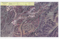
The map offered on this page was issued by Jefferson County according to the
description of the Sugar Creek Hills defined boundary. This image file size is large due to the size of the original scanned and
the level of resolution needed to be of use. The aerial view is ~6.5MB and
is in .jpg file format.
Clicking on the thumbnails opens the image in your browser; however, I would
recommend saving them to your hard drive and opening them up in a graphics
program that allows you to zoom in on the image. If you want to
download or save the images to your hard drive, right click the thumbnail and
select "save picture as". Either change the folder to where it will save
it or make a note of the folder it is saving to so that you can locate it
afterward. If you have dial-up, this can take quite awhile to download.
|
|
|
|

|
|
|
|
Proposed incorporation boundary. |
|
The red outlined area is the proposed incorporation boundary. |
|
|
|
|
|
| 